Property Record
522 Carter St, San Francisco, CA 94134


Save to a Folder
{{folder.Name}}
{{folder.ListingIds.length}} Properties
{{folder.ListingIds.length}} Property
Create a New Folder
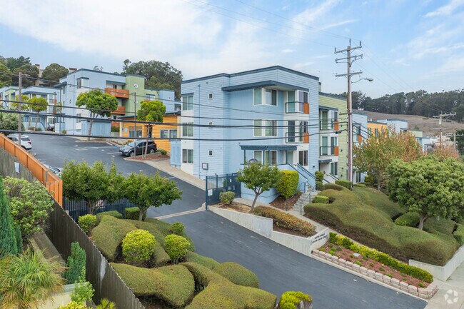
Property Detail
522 Carter St
6428-008
SAN FRANCISCO
Apartment
California
RH-2/NC-S
8
B and X Area of moderate flood hazard, usually the area between the limits of the 100-year and 500-year floods.
3.36 AC
2024
Crocker Amazon
2025
San Francisco
026302
San Francisco-San Mateo-Redwood City, CA
112,474 SF
NEARBY LISTINGS FOR SALE OR LEASE
DEMOGRAPHICS near 522 Carter St
1 mile
3 mile
5 mile
2025 Total Population
35,480
276,354
695,614
2030 Population
35,171
275,054
700,049
Pop Growth 2025-2030
(0.87%)
(0.47%)
+ 0.64%
Average Age
43
43
42
2025 Total Households
9,882
88,997
254,490
HH Growth 2025-2030
(0.93%)
(0.38%)
+ 0.81%
Median Household Inc
$99,059
$124,889
$134,734
Avg Household Size
3.40
2.90
2.60
2025 Avg HH Vehicles
2.00
2.00
1.00
Median Home Value
$1,031,542
$1,072,720
$1,086,259
Median Year Built
1953
1951
1954
Nearby Places
Map Layers
Map Styles
 Street
 Aerial
Layers
 Traffic
 Biking
Places
Listings with unknown addresses are not visible on the map
- Restaurants
- Banks
- Shops
- Fitness
- Groceries
PUBLIC TRANSPORTATION
COMMUTER RAIL
Bayshore Caltrain Station Northbound (Local Weekday - Caltrain (Caltrain), Local Weekend - Caltrain (Caltrain))
Drive
Walk
Distance
Bayshore Caltrain Station Northbound (Local Weekday - Caltrain (Caltrain), Local Weekend - Caltrain (Caltrain))
5 min
2.0 mi
22Nd Street Caltrain Station Northbound (Express - Caltrain (Caltrain), Limited - Caltrain (Caltrain), Local Weekday - Caltrain (Caltrain), Local Weekend - Caltrain (Caltrain))
Drive
Walk
Distance
22Nd Street Caltrain Station Northbound (Express - Caltrain (Caltrain), Limited - Caltrain (Caltrain), Local Weekday - Caltrain (Caltrain), Local Weekend - Caltrain (Caltrain))
10 min
5.3 mi
AIRPORT
San Francisco International
Drive
Walk
Distance
San Francisco International
16 min
8.9 mi
Metro Oakland International
Drive
Walk
Distance
Metro Oakland International
39 min
25.6 mi
Freight Ports
Port of San Francisco
Drive
Walk
Distance
Port of San Francisco
15 min
8.4 mi
Nearby Properties
Address
Land Use
TOTAL SIZE
Lot Size
Zoning
Address
Land Use
TOTAL SIZE
Lot Size
Zoning
248,303 SF
4.35 AC
Address
Land Use
TOTAL SIZE
Lot Size
Zoning
312,191 SF
2.74 AC
Address
Land Use
TOTAL SIZE
Lot Size
Zoning
346,710 SF
7.45 AC
RH2
Address
Land Use
TOTAL SIZE
Lot Size
Zoning
54,000 SF
1.67 AC
PDR2
Address
Land Use
TOTAL SIZE
Lot Size
Zoning
42.95 AC
Address
Land Use
TOTAL SIZE
Lot Size
Zoning
439,294 SF
5.43 AC
PDR2
Address
Land Use
TOTAL SIZE
Lot Size
Zoning
143,920 SF
7.29 AC
PDR2
Address
Land Use
TOTAL SIZE
Lot Size
Zoning
183,284 SF
6.85 AC
PD0000
Address
Land Use
TOTAL SIZE
Lot Size
Zoning
28,300 SF
4.94 AC
M2
Address
Land Use
TOTAL SIZE
Lot Size
Zoning
160,983 SF
1.84 AC
NC2
Address
Land Use
TOTAL SIZE
Lot Size
Zoning
268,042 SF
15.01 AC
A00000
Address
Land Use
TOTAL SIZE
Lot Size
Zoning
218,600 SF
12 AC
M10000
Address
Land Use
TOTAL SIZE
Lot Size
Zoning
13,200 SF
3.54 AC
PDR2
Address
Land Use
TOTAL SIZE
Lot Size
Zoning
1.33 AC
M1
Address
Land Use
TOTAL SIZE
Lot Size
Zoning
279,560 SF
13.24 AC
M10000
Address
Land Use
TOTAL SIZE
Lot Size
Zoning
31,400 SF
2.76 AC
PDR2
Address
Land Use
TOTAL SIZE
Lot Size
Zoning
160,000 SF
1.27 AC
C2
Address
Land Use
TOTAL SIZE
Lot Size
Zoning
95,469 SF
3.68 AC
RH-1
Address
Land Use
TOTAL SIZE
Lot Size
Zoning
12,555 SF
0.74 AC
NCS
Address
Land Use
TOTAL SIZE
Lot Size
Zoning
3.77 AC
Address
Land Use
TOTAL SIZE
Lot Size
Zoning
63,943 SF
0.77 AC
Address
Land Use
TOTAL SIZE
Lot Size
Zoning
2.62 AC
RH1
Address
Land Use
TOTAL SIZE
Lot Size
Zoning
6.87 AC
RH2
Address
Land Use
TOTAL SIZE
Lot Size
Zoning
107,362 SF
5.74 AC
M1
Address
Land Use
TOTAL SIZE
Lot Size
Zoning
181,172 SF
2.11 AC
Address
Land Use
TOTAL SIZE
Lot Size
Zoning
22.30 AC
Address
Land Use
TOTAL SIZE
Lot Size
Zoning
73.91 AC
Address
Land Use
TOTAL SIZE
Lot Size
Zoning
206.09 AC
Address
Land Use
TOTAL SIZE
Lot Size
Zoning
44,890 SF
1.48 AC
M1
Address
Land Use
TOTAL SIZE
Lot Size
Zoning
67,432 SF
4.55 AC
CL00C1
The World's #1 Commercial Real Estate Marketplace
Connect with us
© 2026 CoStar Group
The information above has been obtained from sources believed reliable. While we do not doubt its accuracy we have not verified it and make no guarantee, warranty or representation about it. It is your responsibility to independently confirm its accuracy and completeness. Any projections, opinions, assumptions, or estimates used are for example only and do not represent the current or future performance of the property. The value of this transaction to you depends on tax and other factors which should be evaluated by your tax, financial, and legal advisors. You and your advisors should conduct a careful, independent investigation of the property to determine to your satisfaction the suitability of the property for your needs.